
Metocean Studies & Offshore Renewable Energy
Baird supplies meteorological and oceanographic analysis and interpretation to define the impacts for coastal projects, assets, and operations. Our modelling expertise ranges from global wind and wave models to small, high-resolution studies in complex regions, including tropical cyclones, tidal and estuarine systems, tsunami simulations, and climate change scenarios. Our field services and geomatics skills are integral to our approach, and they are essential to our analytical services and to developing and validating high-quality models.
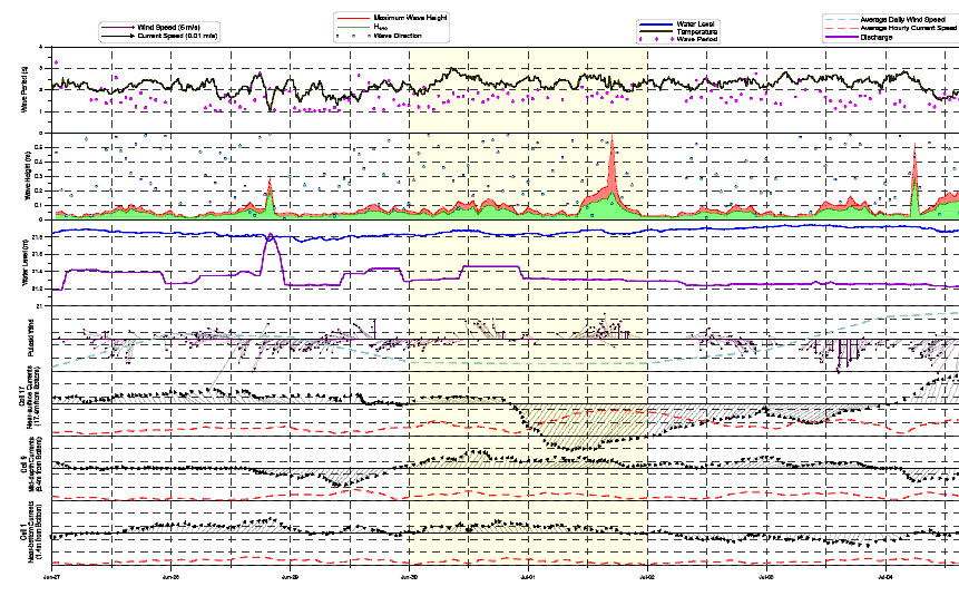
Metocean Analysis
Metocean conditions are often the driving forces in the development of marine facilities. Operability of marine facilities is affected by day-to-day metocean conditions, while structural survival during extreme conditions is critical to the design.
Baird carries out wave hindcasts and forecasts for clients in both regional areas and on global scales. Baird uses field instrumentation and remote sensing of wind and wave conditions to produce calibrated and verified metocean conditions both in deep water and in nearshore locations. Quality metocean analyses allow for facility optimization and improved cost efficiencies.
Numerical Modelling – Wind & Waves
The evaluation of wind and wave climates is an essential first step in most coastal engineering projects. Wind and waves are basic physical forces that shape our shorelines and often govern the design of coastal structures. Establishing a reliable estimate of the severity and frequency of occurrence of the wind/wave climate at a project site is a critical aspect of most coastal projects.
Baird completes wave modelling at scales ranging from global simulations, to detailed processes around coastal structures. Wave dynamics are complex and highly variable, and Baird employs a suite of sophisticated modelling tools to address the range of challenges that may be encountered. These models have been thoroughly tested against both field and laboratory data, and the accuracy and reliability of the models have been demonstrated on hundreds of projects worldwide.
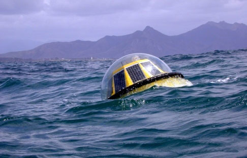
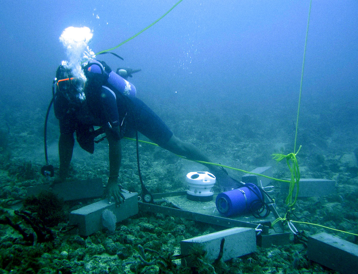
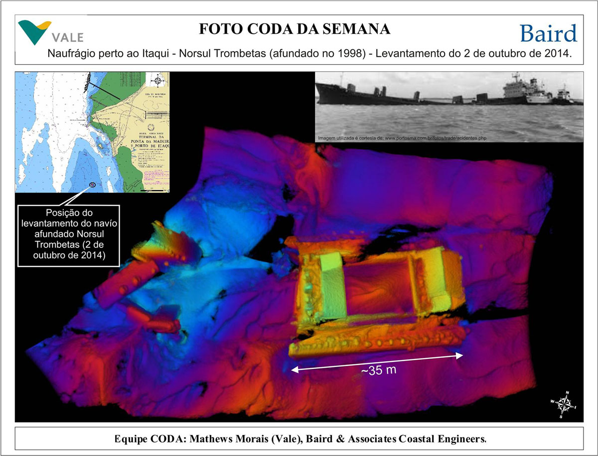
Field Services
Baird’s field services provide the data vital for assessing project feasibility, monitoring performance, supporting engineering analyses and defining project geometry.
Baird can mobilize and operate multiple numerous combinations of field equipment. Wave gauges, current meters, sonar, differential global positioning, geophysical instruments, sediment samplers and specialized hydrographic surveying computer hardware and software are utilized to match specific project requirements.
Baird’s engineers are involved with all aspects of the project, including data collection, analysis and interpretation. This approach is particularly effective in the field. Understanding the project in its entirety, and the technical challenges faced, facilitates decision-making in the field to adjust the collection program to provide maximum project benefit.
Whatever the conditions, Baird’s professionals are ready to undertake the fieldwork that will best serve our clients’ needs.